Where the Andes Drop Off the Edge
Bolivia does not lack for spectacle. The Salar de Uyuni stretches across the southwest like a mirror left out in the sun, drawing travelers who want their photographs to look like they are walking on clouds. But a growing number of cyclists are skipping the salt entirely and heading north from La Paz, toward a narrow dirt road carved into the face of the Andes that drops more than 3,500 meters in a single descent. The Yungas Road – officially known as the North Yungas Road – has been drawing thrill-seekers since the 1990s, and it is not slowing down.
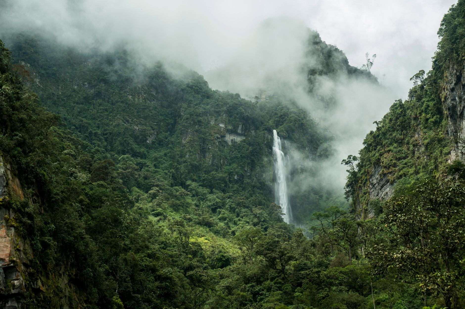
What makes this route remarkable is not just the drop in elevation but the speed at which the landscape changes around you. Within the span of a few hours on a bike, riders move from the cold, sparse altiplano into dense cloud forest, where humidity rises, the air thickens with the smell of vegetation, and waterfalls cut straight across the road. It is a descent that feels geological in its scale – and increasingly, it is the reason people book flights to Bolivia in the first place.
The Road’s Reputation and What It Actually Means
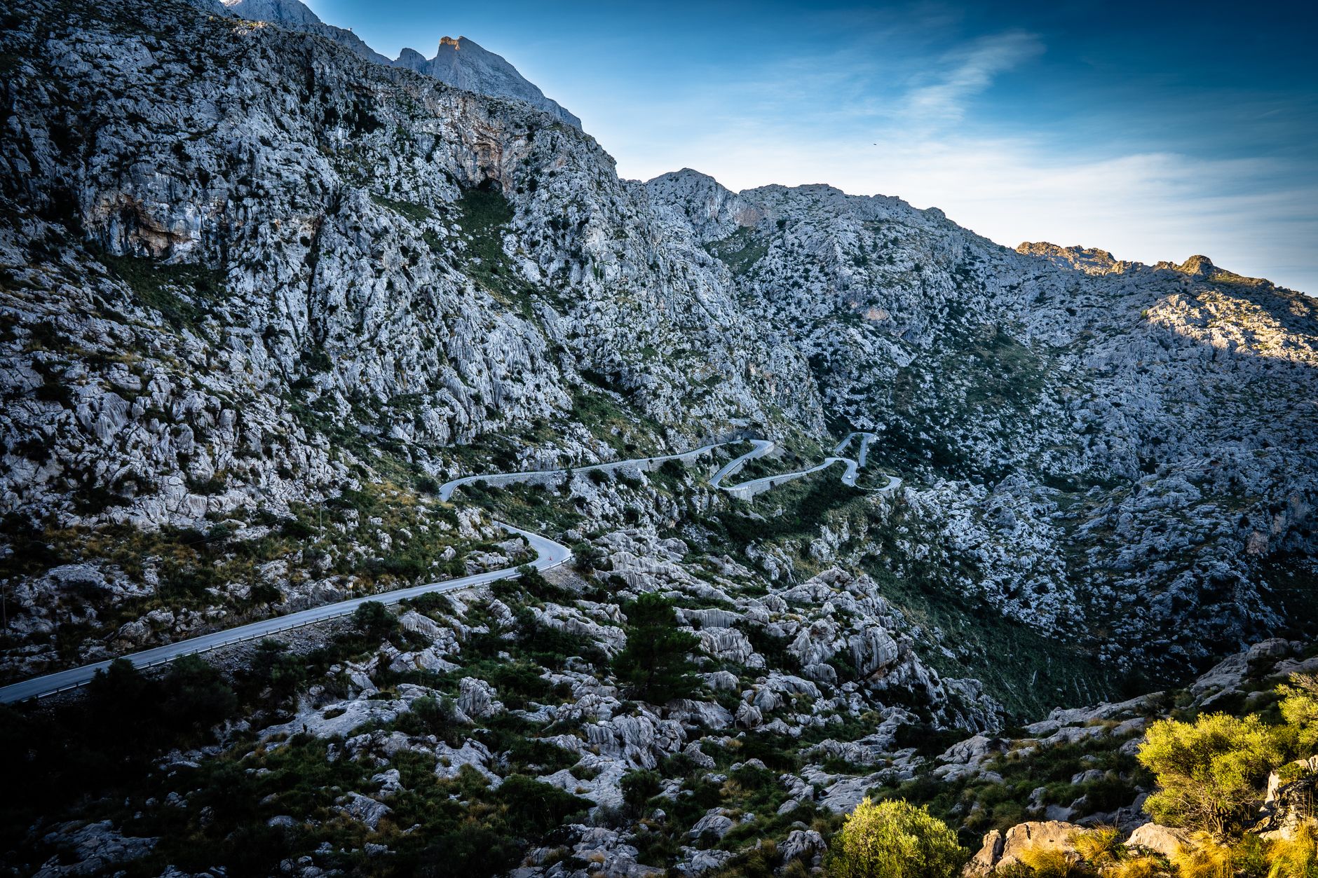
The Yungas Road earned its grim nickname, “Death Road,” from a period when it served as the primary transport route between La Paz and the Yungas region, with no guardrails, single-lane traffic in both directions, and sheer drops reaching hundreds of meters on the left side. Cargo trucks and buses navigated it daily, and the casualty rate during those decades was genuinely staggering. A new road was completed in the early 2000s to handle the bulk of vehicle traffic, which shifted the original route’s status dramatically. Once the trucks moved on, the old road became something else: a playground for mountain bikers.
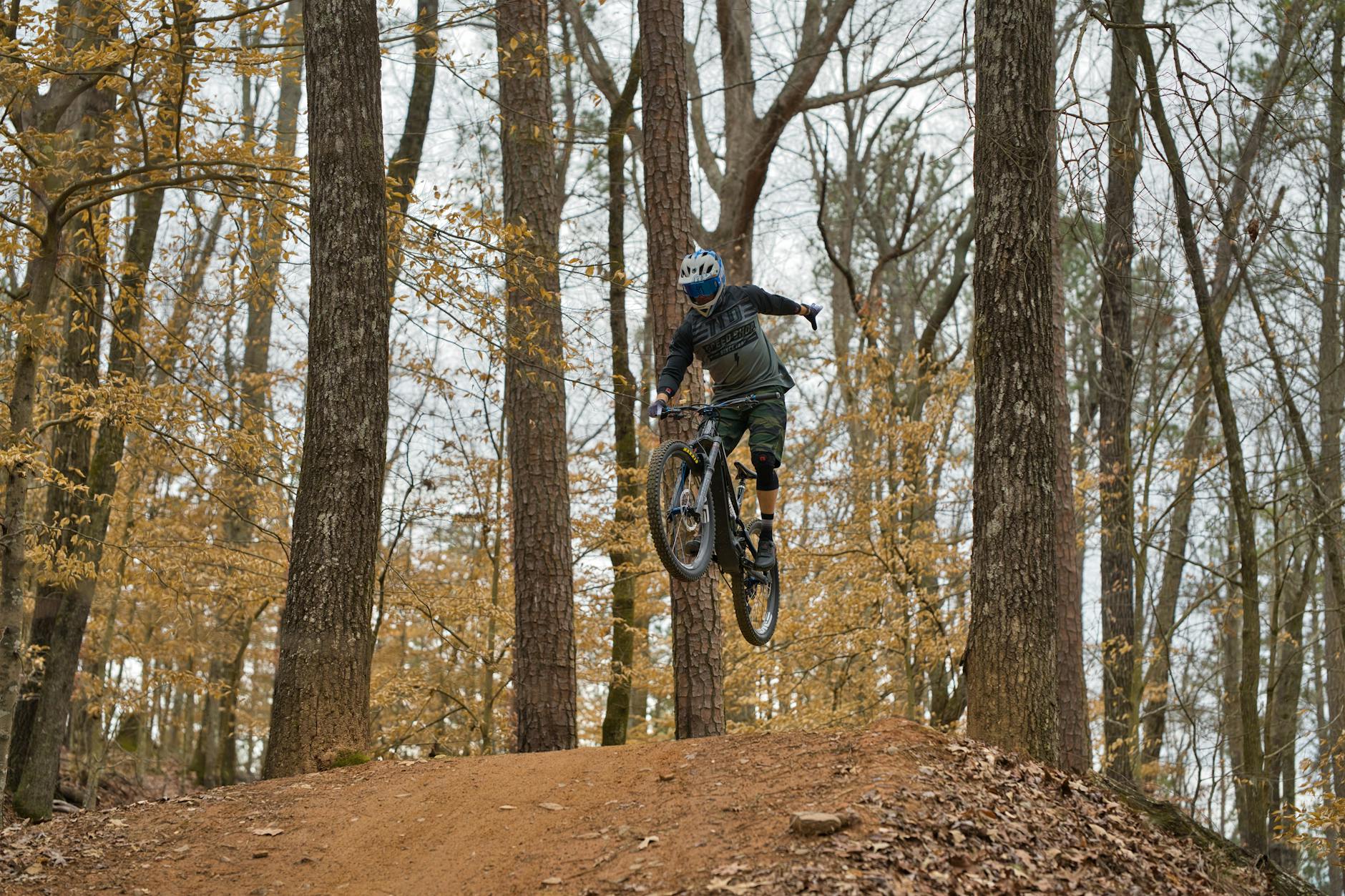
Tour operators in La Paz began running guided descents almost immediately after vehicle traffic decreased, and the format they established has remained largely consistent. Groups of between six and twenty riders are taken by van to the starting point near La Cumbre pass, outfitted with helmets, gloves, and full-suspension bikes, and then set loose on approximately 64 kilometers of road that winds downward through cloud and switchback. The operators manage the logistics so effectively that the experience feels structured without feeling sanitized – riders still need to pay attention, stay to the left edge where the road drops away, and maintain control on loose gravel and wet sections.
The road surface itself deserves more attention than most promotional materials give it. It is not a smooth trail. There are sections of loose rock, stretches where runoff has carved channels across the path, and tight corners where visibility is minimal. Riders with no cycling experience occasionally underestimate this, and the better operators are selective about who they allow to continue past the first few kilometers if someone is clearly struggling. The adventure category is genuine, not marketing language dressed up to sell a comfortable excursion.
Seasonal timing matters more here than most cycling destinations. The dry season running from May through October offers the most predictable conditions, with clearer skies and firmer road surfaces. The wet season does not shut the road down – many operators continue year-round – but rain transforms the experience significantly. Mud accumulates, the road becomes slick in ways that require real skill to manage, and visibility through the cloud forest drops. Some riders specifically seek out the wet season for exactly this reason, though it represents a different kind of difficulty than most first-timers are prepared for.
La Paz as a Base: The City Before the Descent
Most riders spend at least two or three days in La Paz before attempting the road, and the city justifies the time independently. Sitting at roughly 3,600 meters above sea level in a dramatic bowl surrounded by mountains, La Paz operates at an altitude that requires acclimatization before any serious physical effort. The standard guidance is to spend a minimum of two full days at altitude before cycling, allowing the body to begin adjusting to reduced oxygen levels. Attempting the descent without this adjustment leads to fatigue that compounds every difficult section of the road.
The city itself rewards the waiting period. The Witches’ Market in the Jaen Street area, the views from the cable car system that connects La Paz to the satellite city of El Alto above it, and the density of small restaurants serving salteñas and api in the morning streets make the acclimatization days feel like travel rather than obligation. The logistics for the Yungas trip are typically arranged through hostels or dedicated tour operators clustered near the city center, and prices vary considerably depending on what level of equipment and group size the operator works with.
What Comes After the Descent
The town of Coroico sits at the bottom of the descent and serves as the standard endpoint for guided tours. It is small, warm, and visibly different in culture and atmosphere from La Paz – the altitude difference alone makes the air feel like a different country. Many riders spend at least one night there before returning to the capital, and a segment of travelers use Coroico as a base for longer stays in the Yungas region, which extends into agricultural valleys producing coca leaf, coffee, and tropical fruit.
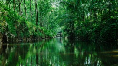
The Yungas region as a whole is less developed for tourism than the altiplano circuit, which is precisely why it attracts the type of traveler who has already done Bolivia’s more famous routes or is deliberately avoiding them. Hiking trails extend into the cloud forest from Coroico, small guesthouses operate at a pace that feels genuinely unhurried, and the population is notably more diverse than the highland cities, with Afro-Bolivian communities maintaining distinct cultural traditions in several villages in the area.
For cyclists specifically, some operators now offer multi-day routes that extend beyond the Yungas Road itself, combining the famous descent with additional trail riding through the surrounding hills. This is a newer development, driven by demand from riders who come specifically for the cycling rather than for the novelty of the death road label. The single-day guided format remains the most common, but the options have broadened in response to a more experienced and more intentional visitor base.
The question operators and longtime visitors keep circling back to is whether the road’s growing profile will eventually change its character. The infrastructure at the bottom – the gear rental shuttles, the restaurants positioned to catch arriving cyclists, the souvenir stalls – already signals a level of commercial organization that was not there a decade ago. Whether that development moves upward into the descent itself, adding more guardrails and safety infrastructure at the cost of the rawness that defines the experience, is the tension that defines the road’s future more than any seasonal weather pattern does.