A Loop That Earns Its Reputation
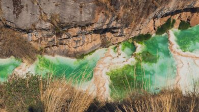
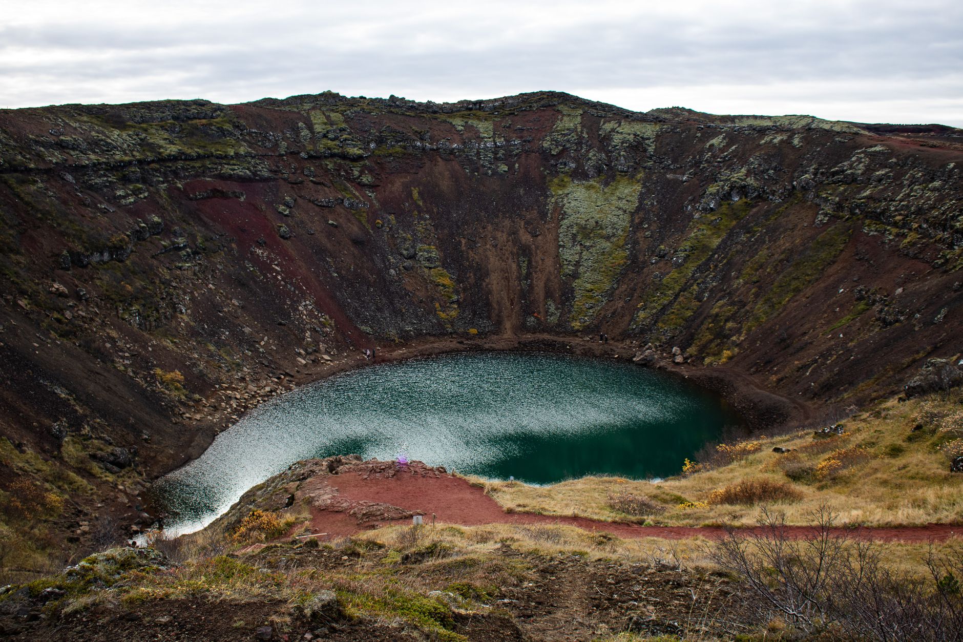
High in the Ecuadorian Andes, roughly three hours south of Quito, a volcanic crater holds one of the most visually arresting lakes on the planet. Laguna Quilotoa sits at nearly 3,900 meters above sea level, its water an otherworldly turquoise-green caused by dissolved minerals and light refraction – a color that reads almost artificial in photographs and somehow even more surreal in person. The lake fills a collapsed caldera, and the trail that encircles the surrounding highlands has quietly built a reputation among serious trekkers as a multi-day walking route with almost nothing to compare against it in South America.
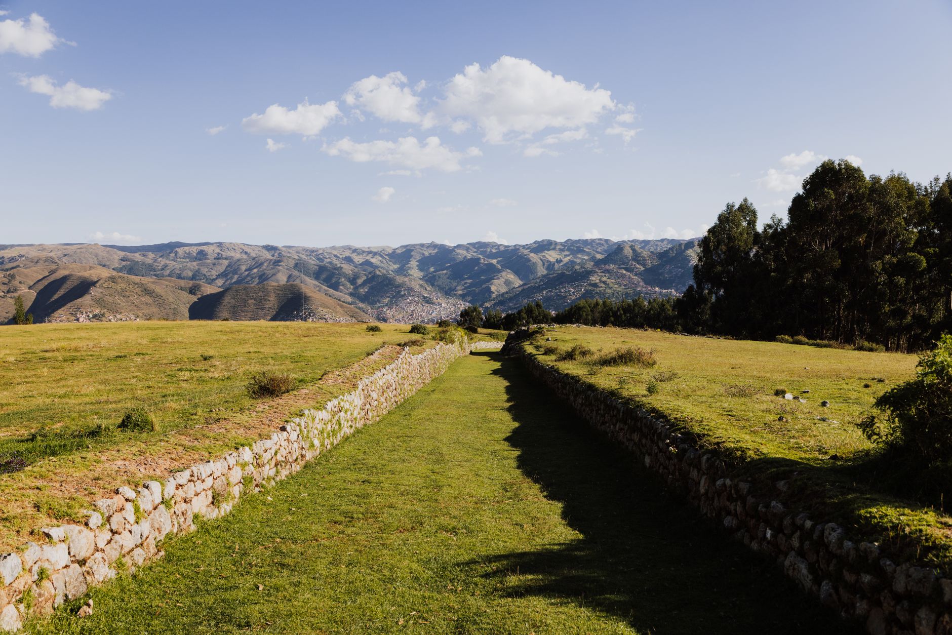
The Quilotoa Loop is not a single trail to the crater and back. It is a four-to-five-day circuit connecting a string of indigenous Kichwa villages through a landscape of deep ravines, patchwork farmland, and high-altitude grassland. Most hikers complete it as a point-to-point route, moving between villages like Sigchos, Chugchilan, and Isinlivi, sleeping in locally run hostels, and descending into the crater basin on the final stretch. The infrastructure is modest by design. The appeal is exactly that.
Why It Keeps Getting Compared to Peru
The comparison to the Inca Trail is not purely about scenery. It is about the nature of the experience – the way the walk delivers history, culture, and physical challenge in one sustained package. The Inca Trail has its stone ruins and cloud forest and, famously, its permit system that limits daily access and drives demand for months in advance. The Quilotoa Loop has no permit requirement, no enforced group size limit, and no fixed departure window. A walker can show up in Latacunga, catch a bus to the trailhead at Sigchos or Quilotoa village, and start the same morning.
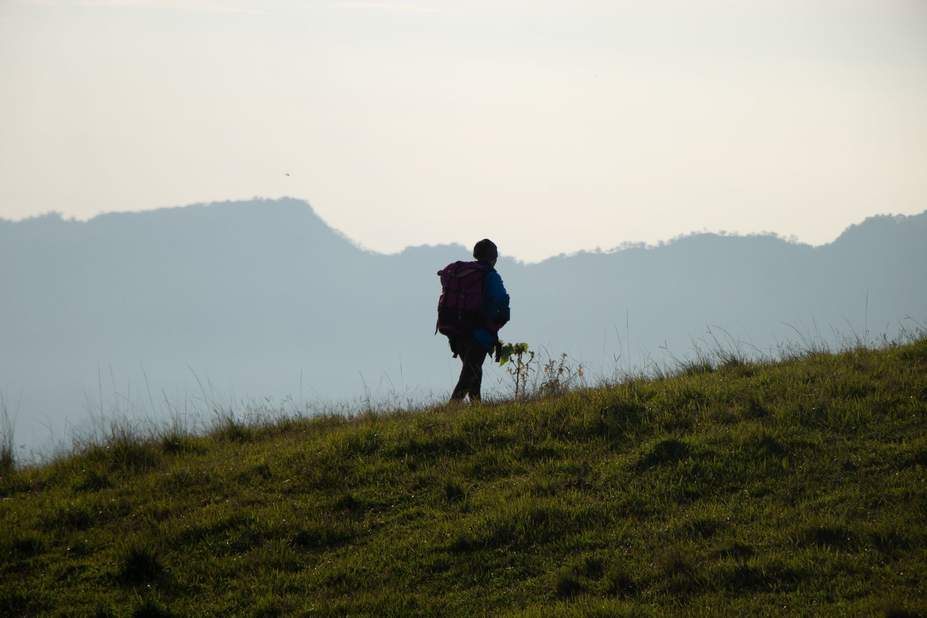
That accessibility cuts both ways. Without the managed crowds of Peru’s flagship route, the loop retains an atmosphere that feels genuinely remote even during its busiest season, which runs roughly from June through September. On any given morning leaving Chugchilan, a walker can go two hours without seeing another tourist. That kind of solitude is increasingly rare on branded multi-day treks anywhere in the Americas. For a growing number of hikers who have already done the Inca Trail or want something less logistically demanding, the Quilotoa Loop is not a consolation prize – it is the deliberate choice.
The physical demands deserve honest attention. The loop involves daily elevation changes between roughly 2,800 and 3,900 meters, and the trail between villages frequently drops hundreds of meters into river gorges before climbing back out. Altitude affects walkers differently, and the acclimatization advantage matters – spending at least two nights in Quito or another high-altitude town before starting is not optional advice, it is practical necessity. The Inca Trail tops out at 4,215 meters at Dead Woman’s Pass; Quilotoa sits slightly lower at its highest point but the sustained effort across multiple days is comparable, and the altitude at which you sleep each night is not dramatically different.
What the loop lacks in archaeological drama – there are no Machu Picchu-scale ruins waiting at the end – it compensates for with immediate cultural texture. The villages along the route are working agricultural communities, not heritage sites preserved for tourism. Market days in Chugchilan draw vendors and farmers from surrounding hillsides in a scene that operates entirely independent of whatever trekking group passed through the night before. The hostels, several of which are owned and operated by local families, serve food grown within a short walk of the kitchen. This is the kind of immersive regional experience that many organized trekking itineraries try to simulate but rarely achieve.
The Crater Itself
Arriving at the crater after days of walking earns the view in a way that a day trip from Quito cannot replicate. From the crater rim, the lake sits roughly 400 meters below, accessible by a steep descent that takes around 30 minutes going down and considerably longer coming back up. At dawn, before the tour buses from Latacunga arrive, the rim is nearly empty. The water color shifts with the angle of light – cooler and greener in morning shadow, almost electric under midday sun.
Canoe rentals are available at the lakeside, and a small number of guesthouses now operate at the bottom of the caldera, making it possible to spend a night at the water’s edge. Sleeping in the crater basin is a peculiar experience – surrounded by steep volcanic walls with no horizon visible – and it appeals to a specific kind of traveler who finds that kind of enclosure clarifying rather than claustrophobic. The loop’s flexibility means hikers can build this detour into their itinerary or skip it entirely and complete the circuit in the standard village-to-village format.
Getting There and Staying There
Most walkers base themselves in Latacunga, a mid-sized city with direct bus connections from Quito’s Quitumbe terminal. From Latacunga, buses and shared taxis run to the various starting points along the loop, including Sigchos for those starting at the far end and working toward the crater, or Quilotoa village directly for those doing the route in reverse. Accommodation along the trail clusters in the guesthouse range, with a few standout family-run operations in Isinlivi and Chugchilan that have built reputations largely through word of mouth and travel forum recommendations. Booking ahead in high season is worth doing; in the shoulder months from October through May, walk-ins are rarely a problem.
Budget requirements for the loop are notably lower than comparable treks in Peru or Patagonia. Guesthouse beds with dinner and breakfast included typically run in the range of $25-45 USD per night depending on the season and what is negotiated. No gear hire services exist at the level found on more commercial trekking routes, so walkers should arrive with their own waterproofs, trekking poles, and layers – temperatures drop sharply after dark at this elevation. The trail itself is well enough marked between villages, but a downloaded offline map or a basic Spanish conversation with guesthouse hosts each morning will prevent the kind of navigational confusion that adds unwanted hours to already demanding days.
Guides can be hired from Latacunga or through guesthouses for those who want them, though the trail is manageable independently for walkers with some experience in high-altitude terrain. The loop has attracted enough attention from international travel media in recent years that English-language trail notes and community-written day-by-day accounts are easy to find before departure. What those accounts rarely capture is the specific quality of silence at 3,600 meters on a clear morning, cloud shadow moving fast across the valley below, and no sound except wind and the occasional dog from a farm somewhere on the hillside – that part does not photograph well and cannot be booked in advance.