The Lake That Shouldn’t Look the Way It Does
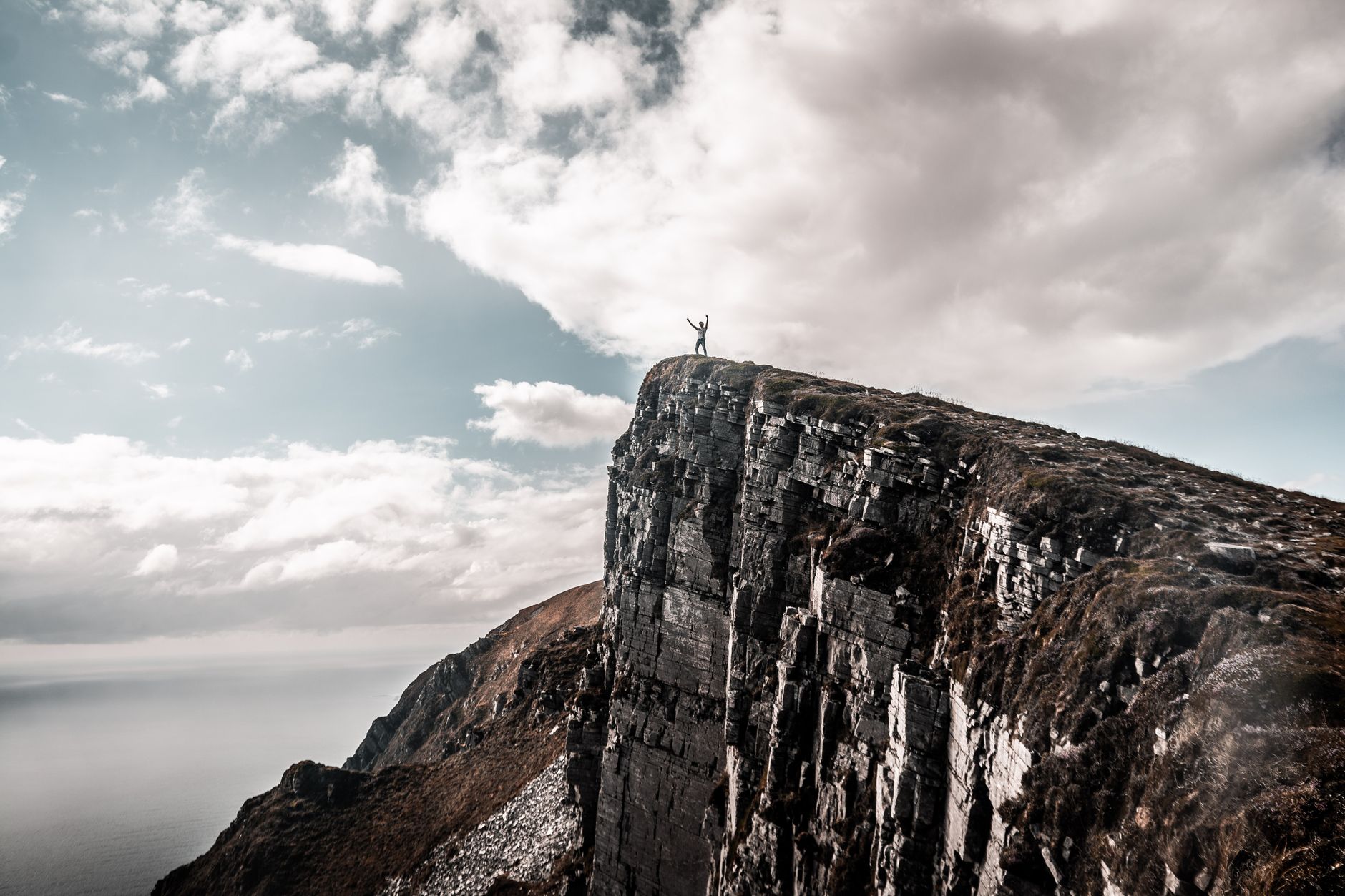
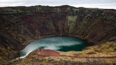
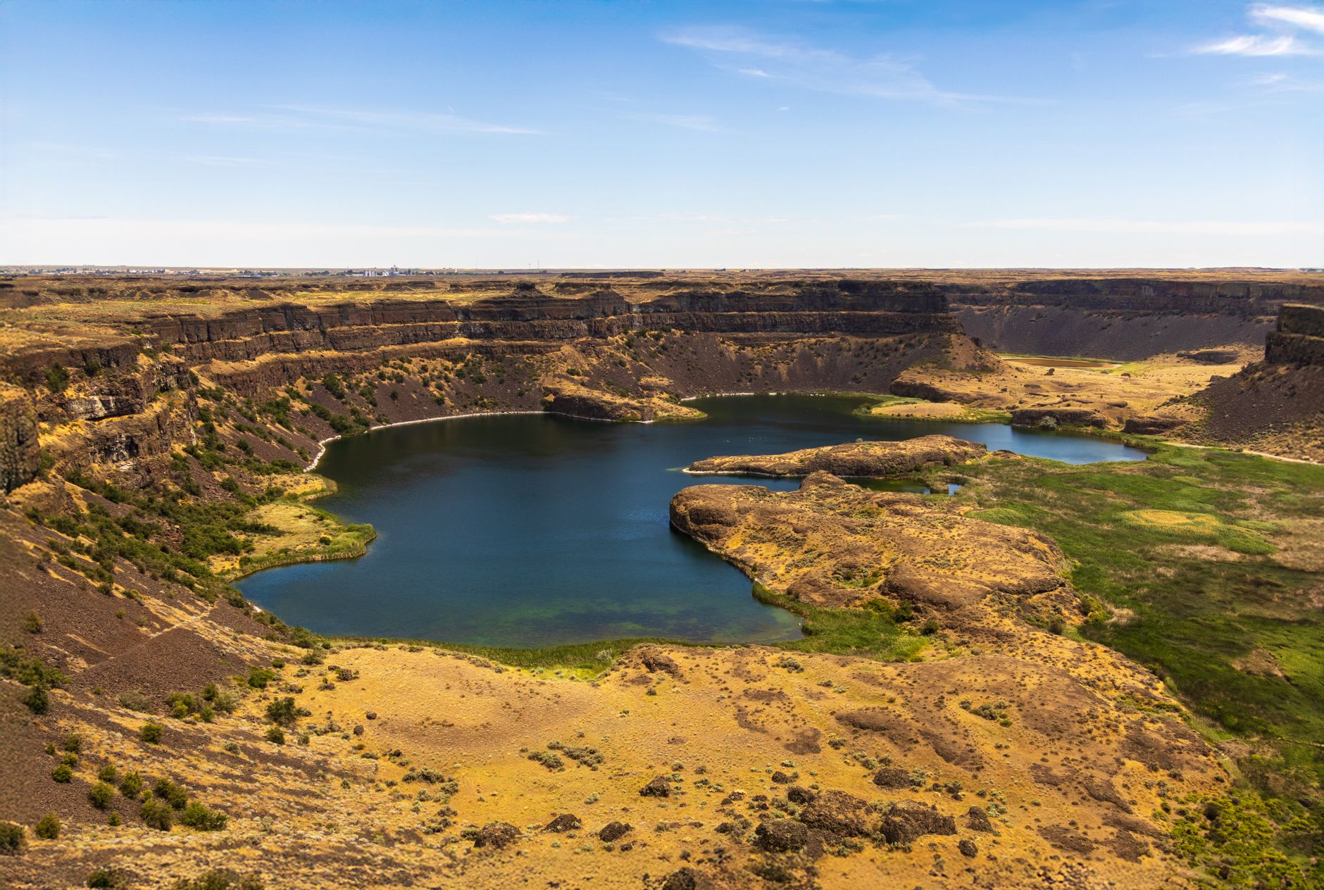
Sørvágsvatn looks broken. From the right vantage point on the Faroe Islands’ largest island, Vagar, the lake appears to float above the Atlantic Ocean, suspended impossibly over a cliff edge with nothing between its still water and the crashing sea below. It is a genuine optical illusion – the kind that makes you question your eyes before you question geography. The lake sits at a higher elevation than the ocean, but the perspective flattens the distance and erases the land between them, producing what looks like a body of fresh water balanced on a precipice with no earthly reason to stay there.
Iceland gets most of the Nordic edge-walking press. Thingvellir, Landmannalaugar, the Snæfellsnes Peninsula – those names circulate constantly among adventure travelers. But the Faroe Islands, sitting roughly halfway between Norway and Iceland in the North Atlantic, have been quietly building a reputation among a narrower, more obsessive category of traveler: people who want to stand somewhere that genuinely unsettles them. Sørvágsvatn – also called Leitisvatn – is the reason many of them book the flight.
Getting There Is Part of It
Vagar is the island where the Faroe Islands’ only international airport sits, which means most visitors pass within a few kilometers of the lake without knowing it’s there. The trailhead for the Sørvágsvatn hike begins near the village of Sørvagur, and the path runs roughly four kilometers out to the cliff overlook at Trælanípa – the name translates loosely to “Slave Cliff,” a reference to old Norse labor history rather than anything you need to worry about underfoot. The walk is graded moderate, with uneven terrain, steep sections near the cliff, and Atlantic wind that doesn’t negotiate.
There is an entry fee to access the trail, managed locally to control foot traffic and fund path maintenance. This is not symbolic. The Faroe Islands have watched other scenic destinations deteriorate under unchecked visitor pressure, and the Trælanípa trail now requires booking in advance during peak months – roughly May through August – when the long daylight hours draw the highest concentration of visitors. Groups are kept to manageable sizes. The whole system is built around the idea that the landscape is worth protecting more than it is worth monetizing at scale.
The cliff edge itself sits roughly 142 meters above the sea. There are no guardrails. That is not an oversight – it is the point. Travelers who make this walk are operating under the understanding that the Faroese approach to outdoor access rests on personal responsibility rather than infrastructure padding. The vertigo is real, the wind can be aggressive, and the photographic opportunity at the edge requires nerve, good footwear, and the willingness to lie flat on damp grass while a companion frames the shot. Many people do exactly that.
Why the Illusion Works
The geometry behind the Sørvágsvatn illusion is straightforward once explained, and somehow less impressive once you understand it. The lake’s far shoreline and the ocean’s surface appear level from the Trælanípa overlook because the intervening cliffside is hidden by the viewing angle. The lake sits at an elevation of around 30 meters above sea level, and the drop to the ocean from the cliff is steep enough that your eye registers ocean, then lake, then sky – with no earth visible between them. The brain fills the gap with the most alarming possible interpretation: that the water is hovering.
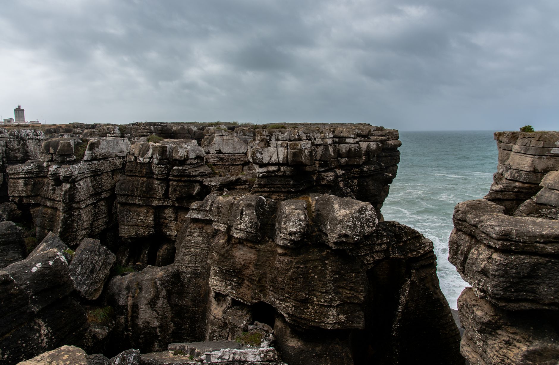
What makes Sørvágsvatn genuinely different from other illusion-based destinations is the surrounding context. The Faroe Islands are not a place of subtle scenery. The islands are raw – covered in short, windswept grass, cut through with dramatic ridgelines, and bordered by sea cliffs that feel more vertical than seems structurally reasonable. Standing at Trælanípa, the illusion is nested inside a landscape that already feels slightly at odds with the normal rules of terrain. The suspension of disbelief is already in effect before the lake even comes into view.
Who Comes Here and What They’re Looking For
The traveler who ends up at Sørvágsvatn is rarely someone who just wandered in. The Faroe Islands require effort – flights typically connect through Copenhagen, Reykjavik, or a handful of other European hubs, and the archipelago offers limited large-scale resort infrastructure. People come because they researched the destination specifically, and many of them are drawn by images of the floating lake that circulate heavily on photography-focused platforms. The gap between photograph and physical experience is one of the more interesting things about this hike: the photograph shows the illusion cleanly, but standing at the edge, with cold wind off the Atlantic and the sound of waves 142 meters below, adds a layer of physical reality that no image transmits.
A growing number of travelers are making the Faroe Islands their primary destination rather than a stopover between Iceland and mainland Europe. The islands have around 50,000 permanent residents spread across 18 islands, and the tourism infrastructure has scaled carefully to avoid overwhelming the communities that live there year-round. Accommodation options range from guesthouses in working fishing villages to a small number of higher-end hotels in the capital, Torshavn. The experience leans local by design – there is no equivalent of a tourist district in the Icelandic sense, no geothermal spa complex catering to cruise passengers. The remoteness is not accidental.
The photography angle cannot be ignored, but it would be wrong to reduce Sørvágsvatn to a content stop. Travelers who make the full hike – out past the lake’s northern shoreline, up to the Trælanípa overlook, and often continuing along the ridge to the sea stack called Boshólmur – report the walk as physically demanding and emotionally absorbing in ways that have nothing to do with framing a shot. The Faroese coast is genuinely stark. There are no trees. The grass runs right to the edge of the cliffs, and on overcast days – which account for the majority of days on these islands – the light flattens everything into a monochrome range of green, gray, and white that feels less like scenery and more like a condition.
Iceland’s south coast and the Snæfellsnes Peninsula have long attracted travelers drawn to landscapes that feel confrontational rather than comfortable, and the comparison to the Faroe Islands is honest without being exact. Iceland has the infrastructure for mass adventure tourism; the Faroe Islands are still working out how much of that they want. Sørvágsvatn draws visitors who have already done Iceland and found it slightly too organized – or travelers who want the North Atlantic edge experience without the tour bus queues at Seljalandsfoss. Whether the Faroes hold that appeal as visitor numbers grow depends entirely on how aggressively the islands protect the very qualities – limited access, preserved silence, absence of handrails – that make places like Trælanípa worth crossing an ocean for.