Nepal’s Mustang Kingdom Quietly Rivals Everest Base Camp for Desert Trekkers

Where the Himalayas Go Dry
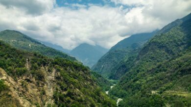
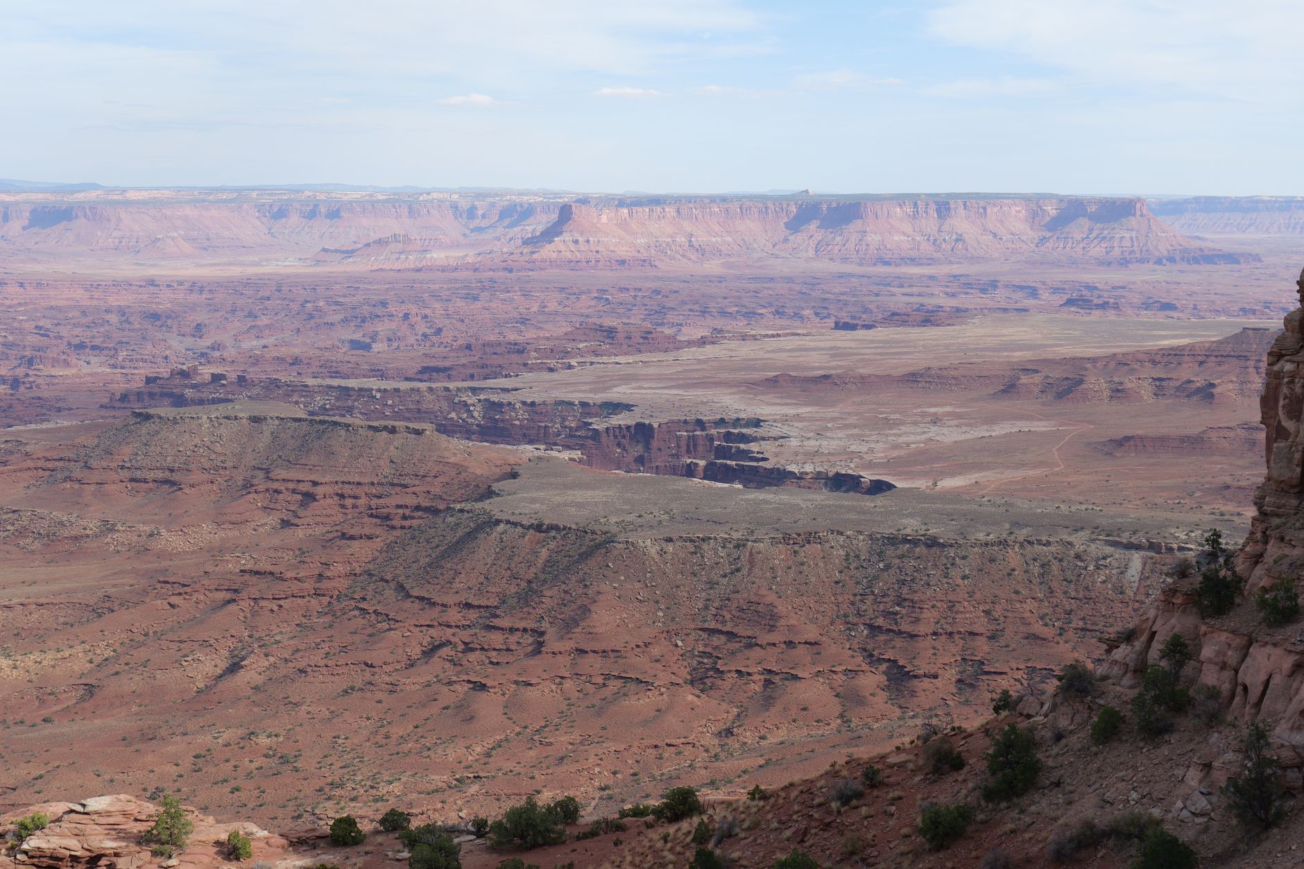
Most trekkers picture Nepal as a green, fog-draped world of prayer flags and altitude sickness. Mustang is something else entirely – a high-altitude desert carved into the Tibetan plateau, hidden behind the Annapurna and Dhaulagiri ranges, where the monsoon loses its reach and the landscape turns ochre, bone-white, and rust red.
A Kingdom That Kept the World Out
Upper Mustang was a restricted zone until 1992 and remains a permit-controlled area today, requiring trekkers to pay a fee that funds conservation and limits daily visitor numbers. That controlled access is the single biggest reason the region has retained what most of Nepal’s overland trails surrendered decades ago: genuine remoteness. The trails through Lo Manthang, the walled capital of the former Kingdom of Lo, carry a fraction of the foot traffic that clogs the Khumbu corridor leading to Everest Base Camp. On many stretches, you will walk for hours without encountering another foreign trekker.
The comparison to Everest Base Camp is not about altitude competition. Base Camp sits at roughly 5,364 meters; the Lo Manthang circuit peaks around 4,000 meters for most standard itineraries. What Mustang offers instead is a completely different physical relationship with the Himalayas. The high peaks here are backdrop rather than destination – enormous white walls visible across a plateau that feels more like eastern Mongolia than a South Asian mountain range. The drama is horizontal as much as vertical.
The permit system, managed through Nepal’s Department of Immigration, currently requires a Restricted Area Permit in addition to the standard Annapurna Conservation Area permit. The cost has historically run significantly higher than open trekking zones, which does filter the visitor profile toward serious trekkers rather than casual day-hikers. That self-selection creates a noticeably different trail culture – quieter camps, longer conversations at teahouses, and a pace that most Everest Base Camp itineraries rarely allow for.
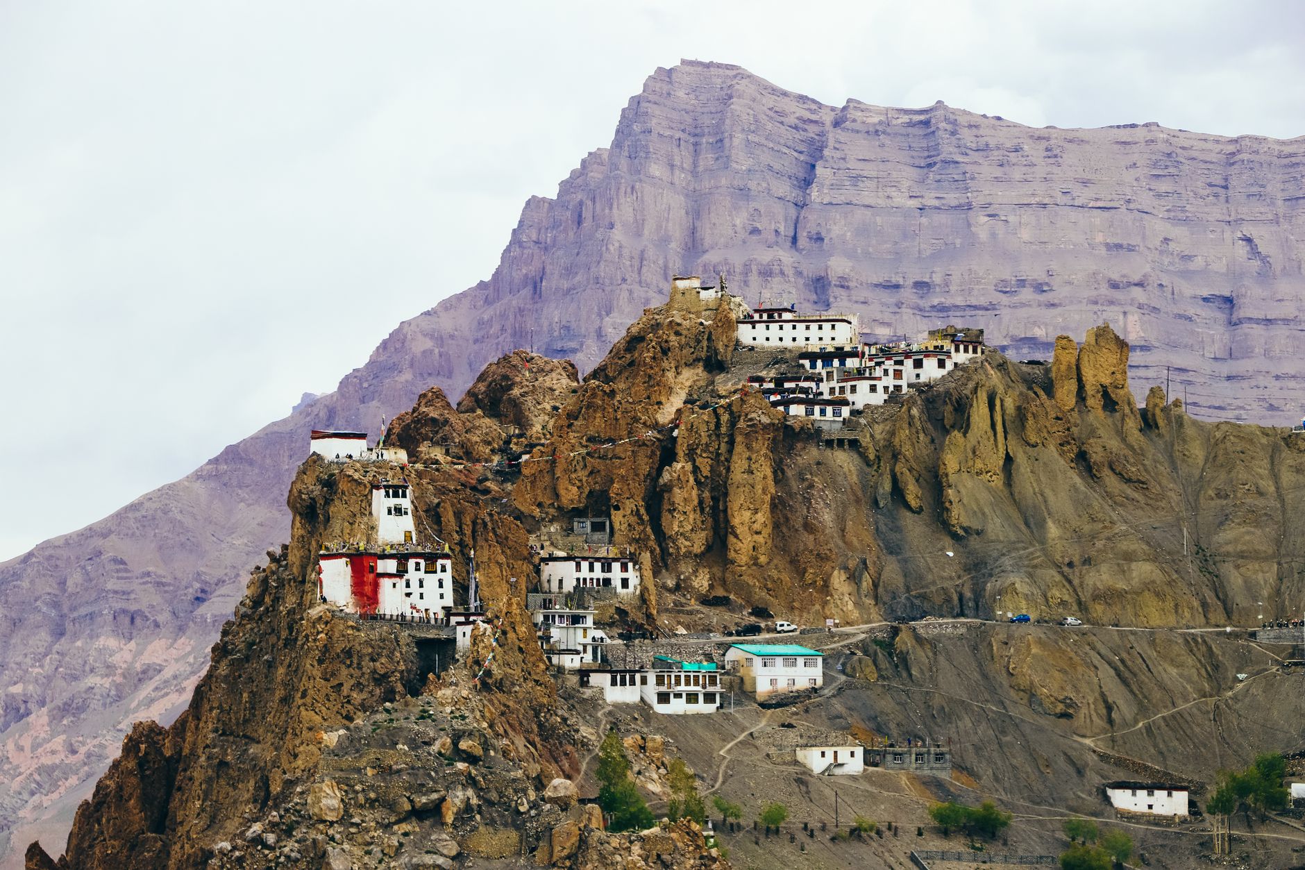
The region’s Tibetan Buddhist heritage is better preserved here than almost anywhere outside Tibet itself, partly because Upper Mustang remained politically semi-autonomous under its king until the Nepali government formally absorbed the territory in 2008. Ancient cave monasteries cut directly into cliff faces, sky-burial sites visible from the trail, and chortens painted in the deep reds and whites of the Sakya tradition give the landscape a visual language that feels centuries removed from Kathmandu’s tourist circuit.
The Desert Trekking Case
Desert trekkers – the subset of long-distance walkers who actively seek arid terrain, wind erosion formations, and the specific silence that only comes with low humidity – have started circling Mustang on their maps for reasons that go beyond novelty. The region sits in a rain shadow so effective that annual precipitation in Lo Manthang is closer to what you would find in parts of the Sahara than in the foothills just two days’ walk south. That aridity produces a trekking environment with almost no mud, minimal leech exposure, and trail conditions that stay consistent across most of the season.
The geology does work that weather cannot. Wind erosion over millions of years has sculpted the plateau into formations that rival anything Jordan or Namibia can offer – layered canyon walls in red and yellow sandstone, mushroom-shaped hoodoos standing above dry riverbeds, and entire hillsides honeycombed with hand-carved cave dwellings that researchers believe housed human communities as far back as the Bronze Age. Some of those cave systems have yielded manuscripts, painted murals, and preserved human remains that archaeologists are still working to date and interpret. The trail effectively runs through an open-air dig site, though access to active excavation areas is restricted.
Trekking season in Mustang runs counter to the rest of Nepal. While most classic Himalayan routes close or become difficult during the June-to-September monsoon, Mustang remains dry and walkable. That means a trekker shut out of the Annapurna Circuit or Langtang in July has a viable, visually spectacular alternative rather than a consolation prize. The trade-off is wind – afternoon gusts in the canyon corridors can be strong enough to stop forward progress on exposed ridgelines – but experienced desert trekkers generally find that preferable to monsoon mud.
Logistics for the trail are increasingly organized, though not in the sanitized way that Everest’s teahouse corridor has become. The route from Jomsom through Kagbeni and north to Lo Manthang is served by small family-run teahouses that have expanded in recent years to accommodate the slowly growing trekker volume. Food options are limited – dal bhat, noodle soups, and locally grown buckwheat feature heavily – and that’s not a drawback for trekkers who prefer meals that are honest about where they come from. Mustang produces apples that have become something of a regional identity; the orchards around Marpha and Tukuche are visible from the trail and the cider is genuinely good.
For trekkers who have already covered the Silk Road high-altitude routes of Central Asia – Tajikistan’s Wakhan Corridor being a comparable arid extreme – Mustang adds a Buddhist cultural layer to desert terrain that Central Asian routes rarely carry. The visual vocabulary is different enough to justify a second long-haul trip for anyone collecting serious wilderness experiences.
What Still Keeps Most Trekkers Away
The permit cost is the most cited deterrent, and it is real. Upper Mustang access fees are structured to be prohibitive by design – the logic being that lower volume protects the cultural sites and limits trail degradation on a plateau where vegetation recovery is nearly impossible given the rainfall levels. Whether that pricing model is fair to trekkers of varying means is a separate and legitimate debate, but the conservation outcome is visible on the trail itself. Lo Manthang’s city walls are intact. The cave monasteries have not been worn down by camera-wielding crowds. The chortens along the route have not been turned into backdrops for social media shoots at scale.
What Mustang cannot offer is the gravitational pull of Everest’s name. Everest Base Camp sells itself with three words that require no explanation at any airport in the world. Mustang requires a sentence – “a high-altitude desert kingdom on the Tibetan plateau with ancient cave monasteries and monsoon-proof trails” – and not everyone has the patience to hear it out. That gap in brand recognition is probably why the trails stay quiet. And for the trekkers who show up anyway, that’s precisely the arrangement they were hoping for.
Frequently Asked Questions
When is the best time to trek in Upper Mustang?
Unlike most Himalayan routes, Upper Mustang is best visited during the monsoon months of June through September, when the rain shadow keeps the plateau dry and walkable.
Do you need a special permit to trek in Upper Mustang?
Yes. Upper Mustang requires a Restricted Area Permit in addition to the standard Annapurna Conservation Area permit, with fees significantly higher than open trekking zones to limit visitor numbers.