Where the Annapurna Circuit Ends, Mustang Begins
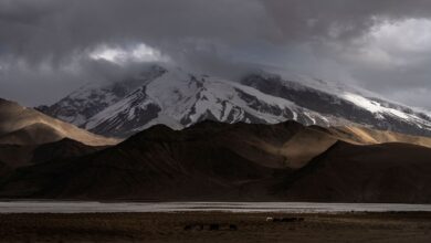
Nepal’s trekking industry built its reputation on the Annapurna Circuit and Everest Base Camp routes, two trails so thoroughly documented that hikers can recite the teahouse menus before they’ve booked a flight. But a growing number of trekkers – those who’ve already collected the postcards and want something harder to reach – are turning north to the Mustang region, a high-altitude desert corridor that sits in the rain shadow of the Himalayas and shares a cultural identity closer to Tibet than to Kathmandu.
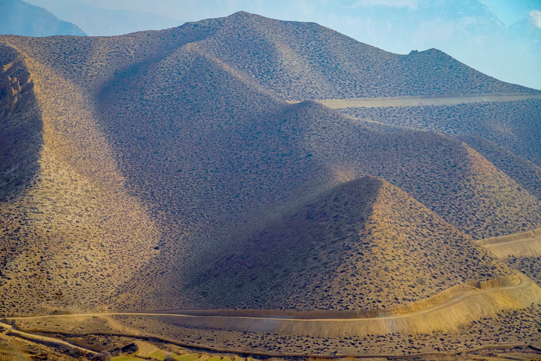
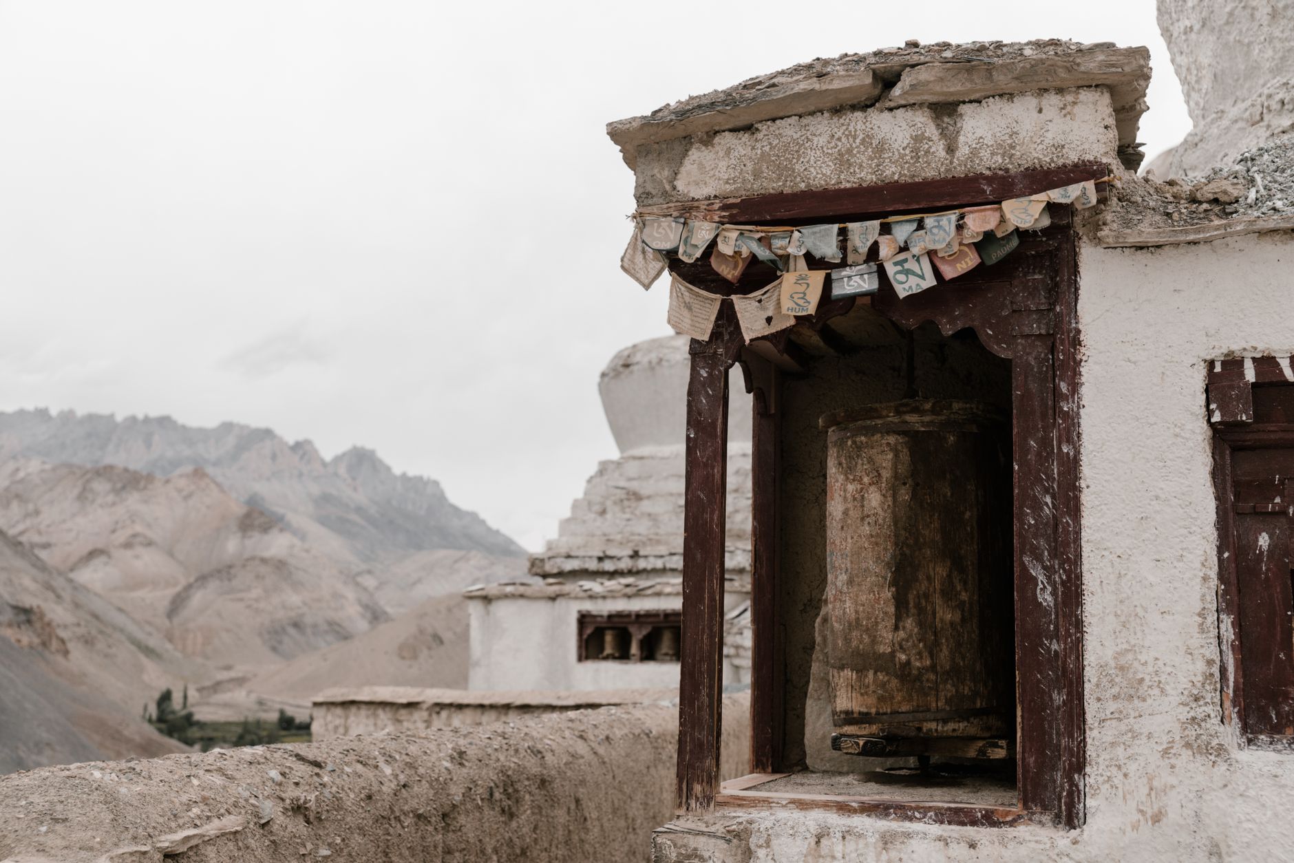
Upper Mustang, the restricted zone that requires a special permit costing several hundred dollars above the standard trekking fee, remained closed to foreign visitors until 1992. That late opening means the trail infrastructure is thinner, the crowds are sparse by Nepali trekking standards, and the landscape – whitewashed cave monasteries carved into terracotta cliffs, walled medieval towns, and wind-scoured plateaus at 4,000 meters – retains a quality that feels genuinely apart from the more accessible routes further south.
The Lay of the Land
Mustang divides into Lower and Upper sections, with the permit requirement applying only to the Upper zone beyond Kagbeni. Lower Mustang is accessible on a standard trekking permit and already offers scenery that differs sharply from the green mountain flanks of the Annapurna foothills. The Kali Gandaki gorge, which cuts through Lower Mustang, is widely recognized as the deepest river gorge on Earth, flanked by Annapurna and Dhaulagiri – both above 8,000 meters – on either side. Trekkers moving through this section pass apple orchards, ancient stupas, and villages where the local dialect and architecture owe more to the Tibetan plateau than to the Nepali hill culture below.
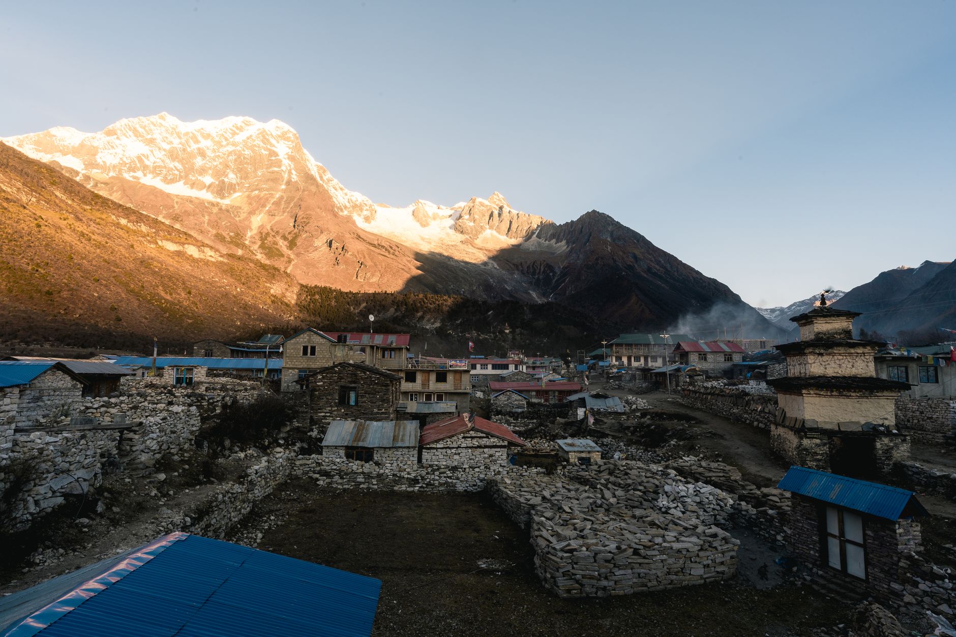
Upper Mustang centers on Lo Manthang, the walled capital of the former Kingdom of Lo, a city that still functions as a living settlement rather than an open-air museum. The ruling family of Lo – whose lineage stretches back to the 14th century – maintained cultural continuity here partly because the geography did the work of isolation for them. The plateau’s aridity and altitude deterred the kind of agricultural migration that reshaped other parts of Nepal, leaving Lo Manthang’s monastery complexes, mural paintings, and ceremonial calendar relatively intact.
Getting to Lo Manthang requires either a six-to-eight-day trek from Kagbeni or a flight into Jomsom, the region’s small airstrip, which cuts the walking approach to three or four days. The Jomsom option is weather-dependent – mountain airstrips operate on narrow windows, and cancellations during monsoon or windy periods are routine. Trekkers who try to compress the itinerary too aggressively often find themselves either stranded in Jomsom or rushing a circuit that rewards a slower pace.
Permit Logistics and Why They Matter
The Upper Mustang restricted area permit currently costs around $500 for the first ten days, with an additional daily fee beyond that. The permit system requires trekkers to move with a licensed guide and is not available for independent trekking, which keeps the annual visitor count well below the numbers that pass through the Annapurna or Everest corridors. That cap, while frustrating for budget-focused travelers, is exactly the mechanism that preserves the character of the place. Teahouses in Lo Manthang remain small family operations rather than the multi-story lodge complexes that now line parts of the Annapurna Circuit.
For trekkers accustomed to routes where a support app provides live lodge availability and trail conditions, Upper Mustang requires a different kind of preparation. Communication infrastructure is limited, the trail crosses remote terrain with minimal rescue access, and altitude-related illness is a real concern for anyone ascending too quickly from Pokhara’s 800-meter elevation to Lo Manthang’s 3,840 meters. A well-planned itinerary builds in acclimatization days at Kagbeni or Chele, not as optional extras but as essential buffer against the kind of headache that turns a bucket-list trek into a medical evacuation.
What the Region Offers That the Classic Routes Don’t
The specific appeal of Mustang is architectural and historical in a way that the more celebrated routes are not. Annapurna and Everest treks are primarily about mountain scale – the overwhelming visual presence of peaks above 7,000 and 8,000 meters. Mustang delivers that scale too, but layers it with a surviving medieval urban culture. The monastery at Thubchen Gompa in Lo Manthang contains 15th-century murals that conservation teams have spent years restoring, working against the deterioration caused by decades of leaking roofs and fluctuating humidity. Visiting during the Tiji Festival – a three-day ceremony in late spring that reenacts the defeat of a demon threatening Lo’s water supply – means watching a ritual calendar that the region has maintained for centuries, now accompanied by monks in elaborate costumes performing cham dances in the walled city’s central square.
The terrain itself shifts constantly in ways that plateau landscapes elsewhere often do not. Wind erosion has shaped the cliffs around Chele and Ghami into formations that resemble the American Southwest more than the Himalayas, with layered reds and oranges cutting through the rock face. The Kali Gandaki riverbed, which trekkers cross multiple times during the circuit, is the source of the sacred ammonite fossils called shaligrams, smooth black stones that Hindus regard as natural representations of Vishnu and that locals collect and sell throughout the valley.
Accommodation quality varies more dramatically here than on the established circuits. In Lo Manthang and Kagbeni, guesthouses are comfortable by mountain standards – heated common rooms, reliable if basic food, and enough hot water for a shower after a dusty day. The villages between, particularly on the eastern loop through Ghami and Garphu, offer more stripped-back conditions. Trekkers who carry a sleeping bag liner, a water filter, and low expectations about menu variety tend to adapt without difficulty. Those who need a charging station and a Wi-Fi connection at every stop will find the gaps in coverage genuinely disorienting.
The route options within Upper Mustang have expanded as local guides have developed a Mustang Circuit that combines the standard Lo Manthang approach with a return via the eastern villages, crossing passes above 4,000 meters and passing through communities that even regular Mustang visitors often miss. This circuit takes closer to two weeks than one, and some trekkers extend it further by continuing south to connect with the Annapurna Circuit proper – a crossover that puts the visual contrast between Mustang’s arid north and Annapurna’s forested southern flanks into sharp, immediate relief. The question for anyone planning this extension is whether the permit budget stretches to cover both systems, since the costs add up faster than the mileage.